

|
|
| School of Geography | ||
Geographical Information ScienceGeographical Information Science (GIS) is a broad field of study concerned especially with the development, use and application of geographical information systems. The group is internationally renowned for its innovative research on the theory and application of GIS with a tradition of developing cross-cutting collaborations both within the School and beyond. Research centres on four inter-linked foci: Earth observation Given the breadth of GIS, the groups activities are supported by funding from a variety of bodies including the AHRC, EPRSC and NERC as well as government agencies and industry. The group supports a large and dynamic postgraduate research (PhD) community as well as providing specialist teaching on the Schools MSc in GIS. The School also hosts the Remote Sensing and Photogrammetry Society (RSPSoc) with theme members holding a number of senior positions in the Society (e.g. Paul Aplin, its chairman, Giles Foody, editor-in-chief of its journal, the International Journal of Remote Sensing, Paul Mather, editor of the Newsletter and Doreen Boyd, co-chair of the LiDAR special interest group). The Centre for Geospatial Science, established jointly with the IESSG in 2005, is a focus for cutting-edge research in the areas of Geoinformatics, Geospatial Intelligence, Interoperability, Location Based Services, and Semantics. 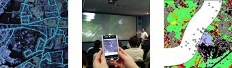 |
||||