School of Geography: Earth Observation and Geospatial Data Science
Our core foci are on environmental remote sensing and applied geographical information systems/science (GIS). Distinctively, our research in Earth observation is undertaken using remote sensing systems operating in optical through thermal to microwave wavelengths. This research is also undertaken at scales from sub-pixel to global and focused on environmental features that are located between the near sub-surface to the uppermost layers of forest canopies.
We use an extensive set of resources, including a fleet of drones and sensors, specialised imaging and visualisation facilities and a high-powered computational suite for analysing and modelling big geospatial data. Our applied research engages in a diverse array of application areas that traverse the social sciences, environmental sciences as well as in geomatics engineering and technology. Given this breadth of application interests, theme members often collaborate in inter-disciplinary research with colleagues in other themes in the School and beyond. Theme members also contribute to research led teaching as well as pedagogic research to help nurture and develop the future geospatial science community.
Data capture
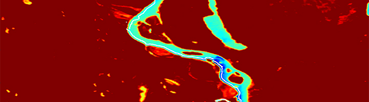
We focus on remote sensing at a range of spatial and temporal scales using a multitude of data capture technology. For example, we use unoccupied aerial systems (UAS), also known as drones, to study lianas in tropical forests using hyperspectral sensor systems and mapping bankside vegetation and river habitats using thermal infrared sensors to explore water temperature patterns. We use satellite sensors to study land cover and its dynamics over large areas to address major science questions, for example, to identify areas of slavery as part of the Rights Lab.
Computational methods
Turning captured data into information requires methodological innovation; a major research strand within the theme. We are at the forefront of testing novel AI algorithms and machine learning methods (as well as human learning through citizen science) to extract environmental metrics from earth observation. This methodological research aims to exploit the information content of rich and diverse geospatial data streams focuses.
Visualisation
We have explored the relative merits of a range of mobile, augmented and virtual technologies across many application domains including teaching environments, museums, immersive laboratory environments, and visitor centres. Recent developments include the development of 3D printed landscape models augmented using novel projection rendering techniques to create engaging displays for community engagement and decision support.