

|
|
| School of Geography | ||
Geographical Information ScienceGeographic Visualisation and Context-Aware Mobile Computing The representation and visualisation of geographic information is fundamental to the way the results of GIS analyses are communicated in an effective and appropriate manner. Research in geographic visualisation in the school has combined inter-disciplinary collaborations with novel technical developments. Examples include the AHRC funded collaboration with artist Derek Hampson which culminated in an exhibition, colloquium and publication Chat Moss, and the Mapping Performance Culture project in collaboration with the School of English Studies. A major recent development has been in laboratory-based and mobile geographic visualisation research to complement HEFCE investment in facilities linked to the SPLINT programme. Priestnall, Burton and Polmear are exploring the design and evaluation of novel interactive environments in the laboratory, and more recently through online virtual worlds like Second Life (the DELVE project, led here by Nick Mount). Developments in spatially-aware mobile computing are occurring rapidly including in-field evaluation of mobile learning (with researchers in the LSRI) and the development of handheld Augmented Reality techniques based on iPhones and using visibility mapping to guide content provision (Goulding, Swan, Priestnall). 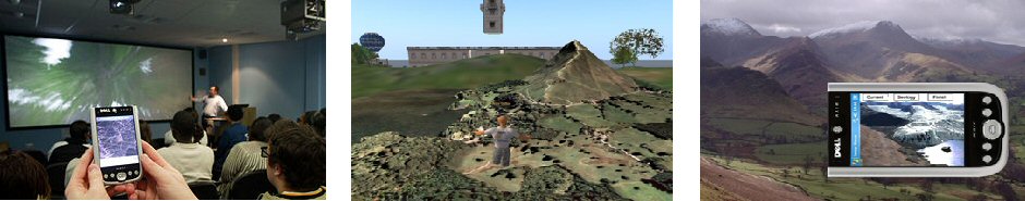
|
|||||||