Overview
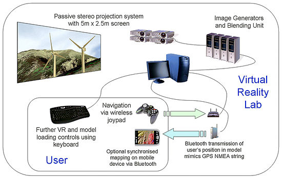
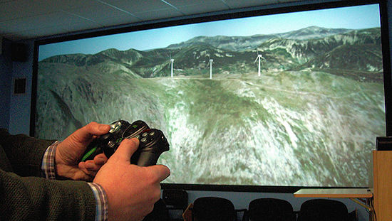
Through the SPLINT (SPatial Literacy IN Teaching) project a semi-immersive Virtual Reality (VR) laboratory has been established. It features two pairs of data projectors creating a 5m wide by 2.5m high image, viewable in 3D through the use of polarised glasses (see Andy Burton's pages for more on developments in visualisation through SPLINT). The video below shows the use of a context map which displays the user's position and cone of vision on a map, synchronised using the Bluetooth transmission of position and orientation data from Vega.
A schematic representation of the lab is shown below.
The real-time rendering software used is Vega Prime utilising Blueberry allowing high quality landscape visualisation but also simulated GPS output for testing spatially aware mobile applications in the lab and driving context maps to assist orientation when navigating the VR environment. The lab was recently used for an MSc in GIS project to locate and visualise wind farms (shown earlier in the video but also below). This project represents a cross-over between SPLINT and the DELVE project.
Video and stills feature imagery supplied by Bluesky and NEXTMap terrain data supplied by Intermap.
Related Outputs
Burton, A., Priestnall, G., Polmear. G., and Mount, N. (2008, in review) Real-Time Landscape Visualisation: Experiences in a Teaching and Learning Context Geographical Information Science Research UK (GISRUK) Conference, 2 - 4 April 2008, Manchester Metropolitan University