Gary Priestnall's Homepage

Research Interests

Current project - Mayson's Ordnance Model of the Lake District


Geoviz

Geographic Visualisation
- Projection Augmented Relief Models (PARM) - Overview - CAS project - EPSRC project
- Digital Terrain Modeling and landscape visualisation.
- Technologies for visualisation in the lab and in fieldwork (see EXAMPLES)
- Locative media (GeoMoLe through SPLINT project, where:now)
- Augmenting the visitor experience - comparative techniques for in-field AR
- GeoSpatial Widgets (including LOCATA) 3D interactive desktop apps
- Collaborative virtual worlds (DELVE project)

GeoRep

Geospatial Representation
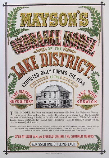
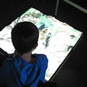
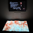
- Terrain represenation and derived mapping, Visibility Analysis (left)
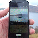
- Remote Geotagging and Query (Zapp smartphone app)
- Mobile Mapping (Rural Divide project, Landmark Salience studies),
- Relationship between maps and 3D models (LOCATA)
- GIS-based data models (Bollin river project and Flood Risk Consortium)
- Object-based Feature extraction (Change detection, ALFIE project)

DigHer

Digital Heritage Applications
- Weather Walks (landscape context of locative media)
- 'Spots of Time' PARM installation at Wordsworth Trust
- Mapping Performance Culture Nottingham (Web-based interactive map)
- Towards Pervasive Media ('Curating the landscape' theme)
- Digital Community History (historical photos & maps via mobiles)
- Raqqa Ancient Industry (GIS & Remote Sensing Project)

GeoArt

Geo-Art Collaborations
- Geo-location of Artworks (Edward Lear, Savage Grandeur)
- Community mapping projects (Real World Mapping)
- Geographer - Artist symposium and exhibition (Mapping Change)
- Technology in context of art exhibitions (Wordsworth Trust)
- Landscape representation and scale (with Jeremy Gardiner via Pervasive Media project)
- AHRC Art-Science fellowship with Derek Hampson (Chat Moss)